Last Sunday, I made another Day of Exploration, as I am wont to do, killing time these last few months, waiting for my hubby's arrival. This time, I decided to wander northward into Virginia, and possibly to visit the highest point in Kentucky, which is directly across the state line and just a bit north of Kingsport, TN.
So with high hopes of scoring another Geological Survey Pin to add to my growing collection, I started out, armed with a Mega Sized coffee from the local Mickey D's. The mountains around the Ridge are beautiful, indeed, both on the TN and the NC side, so I had very high hopes for the mountains of VA. As I sipped on my coffee in the parking lot and studied my map, the name Walker Mountain caught my eye....a very large ridgeline, due north up I-81 from me, going toward Roanoke. And there was a lookout point shown on the map. Well....I just couldn't let that pass, especially since I saw a way to make a loop of it and come back down by Black Mtn, KY, which was where I had originally decided to explore. So off I went.
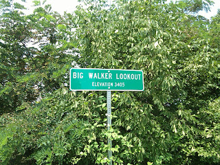
The drive north was very nice...not breathtakingly beautiful, like what I am used to, but I guess maybe after all these months of living i n Eden, I'm just spoiled. Miles of open farmland and rolling hills, with an occasional decent-sized ridgeline on one or both sides. A few miles before I crossed I-77, I saw it...Walker Mtn., stretching off to my left. Several minutes later, I jumped off the highway onto a backroad that would bypass the freeway tunnel under the mountain itself, but would also take me to the summit...to Big Walker Lookout. I had high hopes, indeed for that!
 n Eden, I'm just spoiled. Miles of open farmland and rolling hills, with an occasional decent-sized ridgeline on one or both sides. A few miles before I crossed I-77, I saw it...Walker Mtn., stretching off to my left. Several minutes later, I jumped off the highway onto a backroad that would bypass the freeway tunnel under the mountain itself, but would also take me to the summit...to Big Walker Lookout. I had high hopes, indeed for that!
A very pretty drive took me to the summit, which I almost passed, for lack of anything other than a beat-up sign or two  announcing my elevation, and an old general store that had seen better days...complete with the requisite biker gang parked out front. But there was a
 small deck at the side of the road with a magnificent view, so I stopped long enough t
 o take a pic or two.
 announcing my elevation, and an old general store that had seen better days...complete with the requisite biker gang parked out front. But there was a
 small deck at the side of the road with a magnificent view, so I stopped long enough t
 o take a pic or two.
 After about ten minutes soaking up the view and observing the blue million butterflies that called the place home, I was once again on the road, up and over the mountain. One parting pic taken over my shoulder on the other side, and I was rolling through some very nice farmland, heading towards I-77, bound for what I thought was KY.
Once back on the interstate, the mountains got more pronounced, and more what I had expected, and the scenery rose considerably in my estimation. This was compounded by the freeway going through a massive mountain by way of the East River Mountain Tunnel, if I recall correctly. I did not take a pic of that, more's the pity. It was impressive, to say the least.
Once through the tunnel, though, I had a rude awakening...the trouble with State maps, I have found, is their veritable lack of knowledge of anything beyond their borders, and the tendency to put legends and information blocks in the very places you need to go once you cross over. What I thought was KY turned out to be West VA, and I exited a few miles up in a town called Princeton, where to my great relief, I found a Mickey D's with both a clean restroom, and a fresh pot of hot coffee waiting for me.
From there, I headed back east, then south on Hwy. 23, which would take me generally toward home, via small towns, but by way of my ultimate destination, which was Black Mtn., KY...the highest point in the state. The hwy wound through WV a bit before turning back into VA, and then I went for miles before finally coming to the road that would ultimately lead me to the summit of the mountain...I hoped. The info on the map was sketchy at best, and I knew that it was gonna be trial and error...like most of my explorations to this point have been.
Although I was fairly disappointed in a general way with the scenery for most of my journey, the road up to the summit did not disappoint. The views, although not nearly as beautiful as the ones I live close to, were nonetheless incredible. Even taking the late afternoon haze into consideration. The only thing to spoil it was the visible strip mining sites on nearby ridgelines, and the fact that it was obvious that I was deep in the middle of coal-mining central...a lot of machinery and gear to be seen. But the ride up...gorgeous.
After my disappointment on Walker Mtn., I was rea lly looking forward to getting to the summit and seeing what KY had t
 o offer her visitors. As it turns out....nothing. Not even a run-down general store. There WAS a gravel turn-around with a spectacular view, an
 d a couple of elevation signs, along with the state line signs. Other than that....nada. Nothing but a view that I'm sure stretched all the way back into TN....which was, by t
 hat time, looking awfully good to me.
 lly looking forward to getting to the summit and seeing what KY had t
 o offer her visitors. As it turns out....nothing. Not even a run-down general store. There WAS a gravel turn-around with a spectacular view, an
 d a couple of elevation signs, along with the state line signs. Other than that....nada. Nothing but a view that I'm sure stretched all the way back into TN....which was, by t
 hat time, looking awfully good to me.
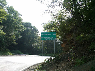
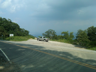
 It was getting late, and home was calling. But I took a couple of pics of the "Gravel Turn-Around" for your enjoyment, so you could see where I was in relationship to the State Line, which you can see next to my truck. Beyond is the view, stretching SE across VA toward TN and NC. And here, you can see a little better the view from the summit, which was beauti
 ful, no doubt. This was taken from just in front of where my truck was parked, looking over the edge. The one to the left was taken across the seat out the passenger window as I drove back down. The road was deserted, so I had no trouble stopping in the road to take a pic or two.
 of the "Gravel Turn-Around" for your enjoyment, so you could see where I was in relationship to the State Line, which you can see next to my truck. Beyond is the view, stretching SE across VA toward TN and NC. And here, you can see a little better the view from the summit, which was beauti
 ful, no doubt. This was taken from just in front of where my truck was parked, looking over the edge. The one to the left was taken across the seat out the passenger window as I drove back down. The road was deserted, so I had no trouble stopping in the road to take a pic or two.
As I started back down the way I had come, I saw many views that I had not seen on the way up. One that particularly caught my interest in terms of perspective was the pic on the left that shows telephone wires crossing the road above me and dropping
  away down the mountain. Taking this pic was dizzying, and I was glad I was in my truck! But it was a fascinating view, nonetheless. Another I was able to get as I began to round one of the many switchback curves. The trees thinned in that spot and afforded an incredibl
 e view that rivaled the one at the summit, although by this time I was more than halfway back down.
 One that particularly caught my interest in terms of perspective was the pic on the left that shows telephone wires crossing the road above me and dropping
  away down the mountain. Taking this pic was dizzying, and I was glad I was in my truck! But it was a fascinating view, nonetheless. Another I was able to get as I began to round one of the many switchback curves. The trees thinned in that spot and afforded an incredibl
 e view that rivaled the one at the summit, although by this time I was more than halfway back down.
One time, I stopped on the side of the road at a small gravel area, and was able to get a pic of the summit, still  just visible past a bend in the road. And once I was mostly back down, I came across a place that allowed me to take a great shot of the entire mountain. So....may I present for your viewing pleasure....Black Mtn., KY...population, none that I could see. If you should ever choose to explore it, let me save you some time....
 just visible past a bend in the road. And once I was mostly back down, I came across a place that allowed me to take a great shot of the entire mountain. So....may I present for your viewing pleasure....Black Mtn., KY...population, none that I could see. If you should ever choose to explore it, let me save you some time....
 Read my blog. It's far more interesting on the whole.

No comments:
Post a Comment